 DroneAirspace
Drone flight planning · South Africa
Know the airspace before you fly.
DroneAirspace is a Burger Labs flight-planning and situational-awareness app for South African drone pilots. It brings airspace, aviation risk, weather and terrain together so a planned location is easier to understand — before an operation.
Available now on iPhone. The Android version is in development.
Before you fly
Understand a location before you fly.
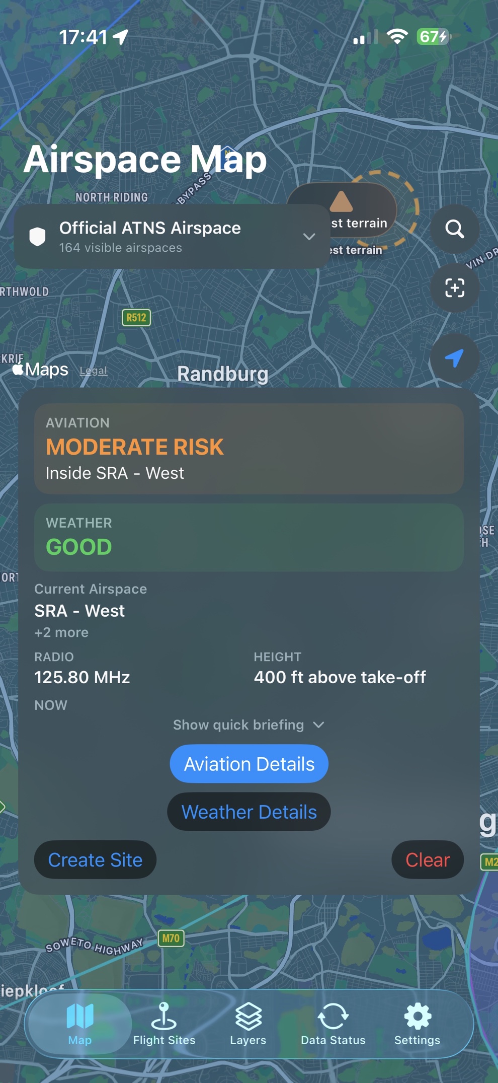
South African drone pilots often have to assemble aviation, airspace, terrain and weather information from different places. DroneAirspace presents the relevant picture in one view, with a clear aviation risk result first.
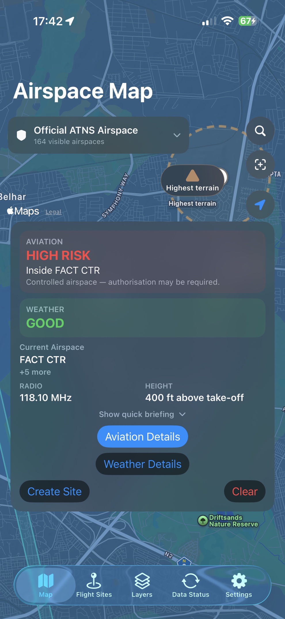
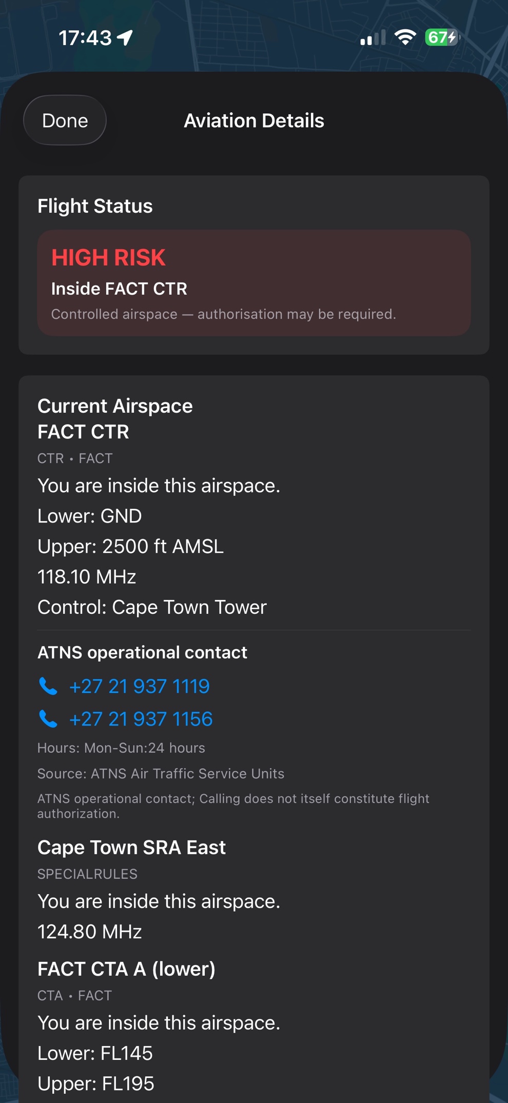
When a location sits inside controlled airspace — such as FACT CTR around Cape Town — the app can show HIGH RISK and the reason. That is planning context, not permission to fly.
Aviation and weather
Airspace and weather are different questions.
DroneAirspace evaluates aviation context separately from weather suitability. A location can be LOW RISK with POOR weather, or HIGH RISK with GOOD weather. That split helps pilots see whether the concern is the airspace, the conditions, or both.
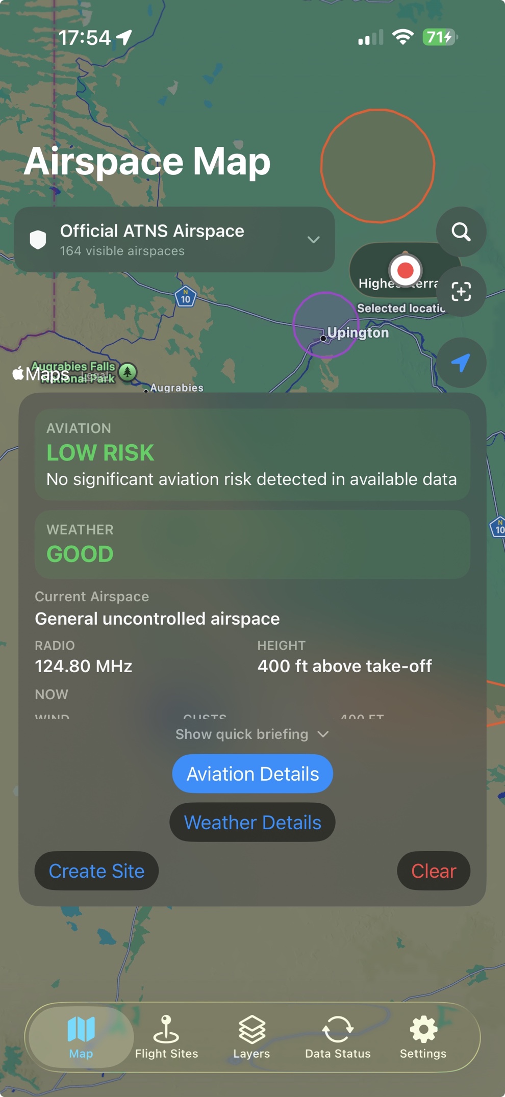
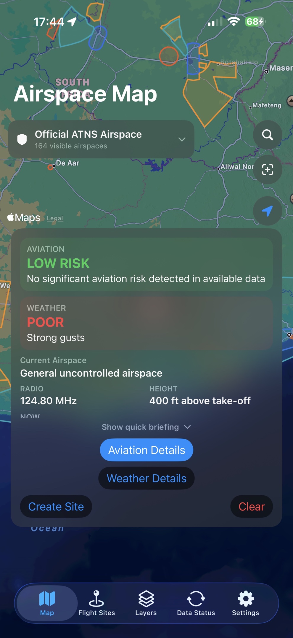
Neither result is regulatory approval. LOW RISK is not a statement that a location is legally safe to fly.
Aviation details
See what’s behind the assessment.
The map result is the first layer. Open Aviation Details when you need the why: current airspace, vertical limits, relevant radio frequencies, operational contacts where available, nearby aerodromes and helistops, nearby airspace, and controlled airspace above the planned flight.
Simple answer first. Deeper information when the pilot needs it.
Terrain
Terrain context around the plan.
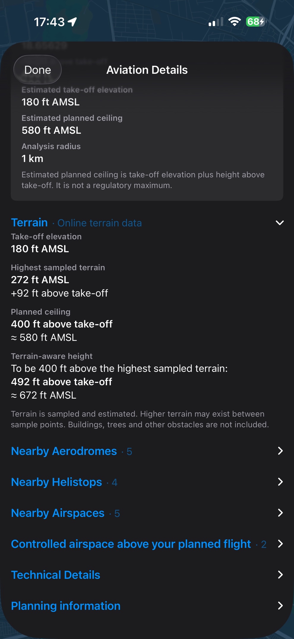
DroneAirspace can show estimated take-off elevation, sampled surrounding terrain and a terrain-aware height next to the planned ceiling. Terrain is sampled and estimated. It does not include buildings, trees or other obstacles, and it is not a clearance guarantee.
Weather planning
Weather that matters to a drone flight.
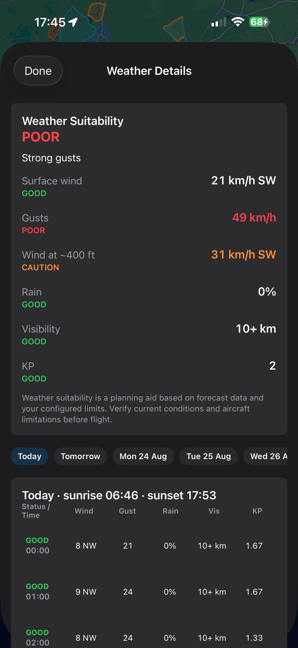
A drone operation cares about more than a generic forecast. Weather Details looks at surface wind, gusts, wind around 400 ft AGL, rain, visibility and KP, plus an hourly outlook — the kind of information that changes whether a flight is practical.
Weather suitability is independent of aviation risk. Poor weather does not change an airspace assessment, and good weather does not reduce HIGH RISK.
Flight sites
Save the places you fly often.
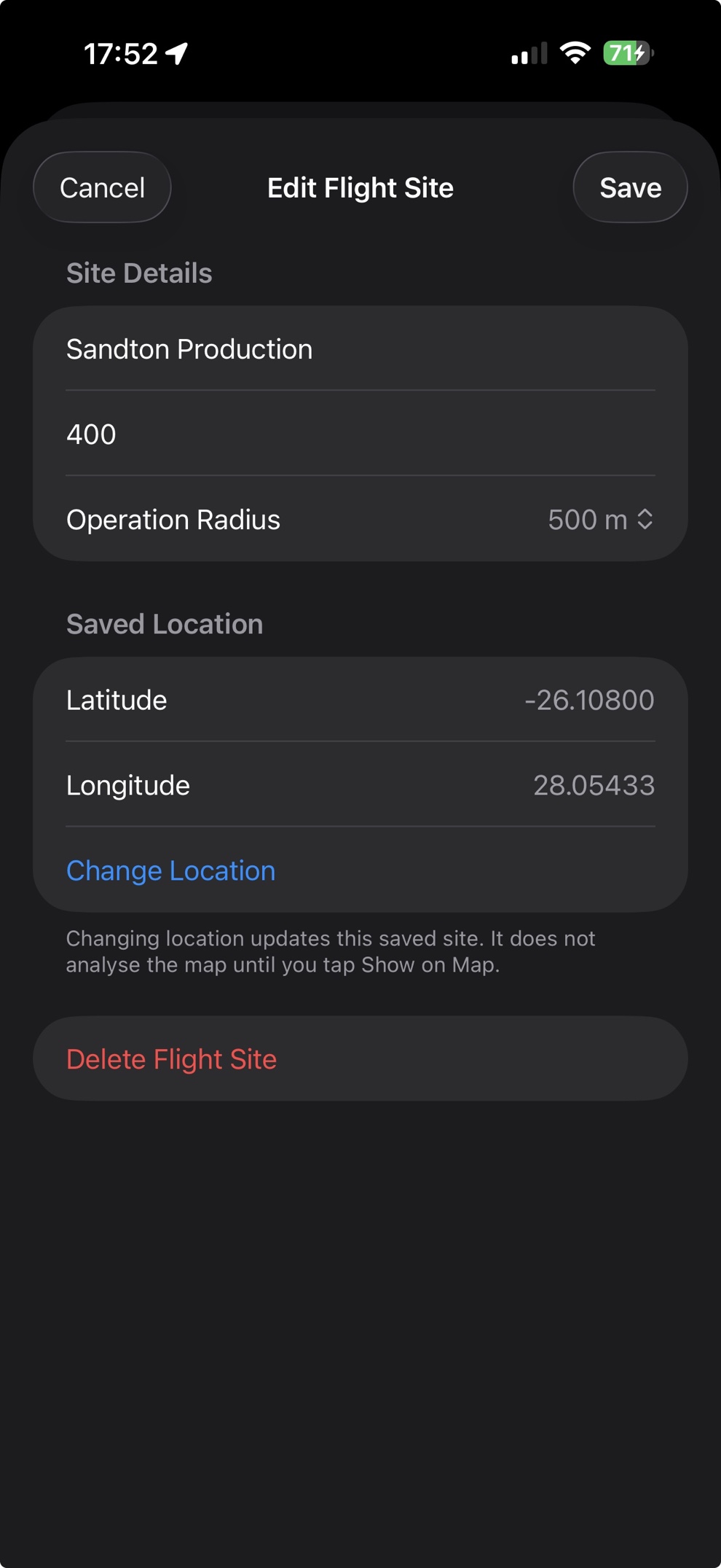
Save regular production locations, client sites or recurring operating areas with coordinates, planned height and operation radius. Reopen a flight site later without rebuilding the plan from scratch.
Official aviation data
Official ATNS airspace data, shown clearly.
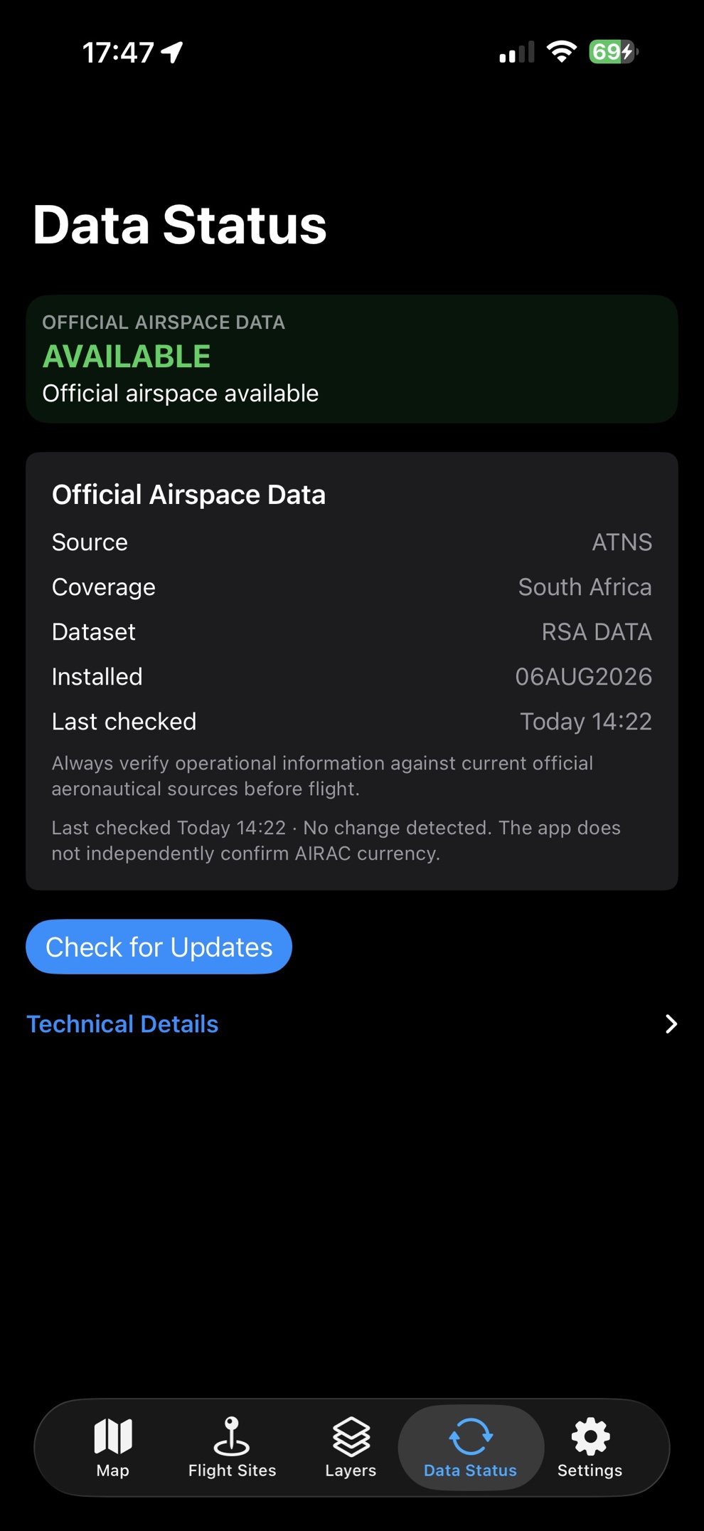
Where available, DroneAirspace uses official ATNS airspace data for South Africa — shown in the app as RSA DATA. Data Status reports the source, coverage and when the dataset was last checked, so pilots can see what they are working from.
Always verify operational information against current official aeronautical sources before flight. DroneAirspace is a planning and situational-awareness aid.
Background
Built from real-world drone operations.
DroneAirspace was developed from experience gained through Aerial Drone Solutions, our founder’s professional aerial cinematography and drone operations business in South Africa.
Flight planning, with the airspace in view.
Available now on iPhone. DroneAirspace is a planning app for South African drone pilots. Enter a location, intended flight height and operating radius to get a clearer view of the airspace and operational considerations around a proposed flight.
Android in development. The Android version is currently being developed.
DroneAirspace is a planning and decision-support tool. It does not grant permission or regulatory approval to fly, and it is not a substitute for legal approvals, NOTAMs, ATC instructions or SACAA regulatory compliance. Always verify current official aeronautical information and operational requirements before an operation.